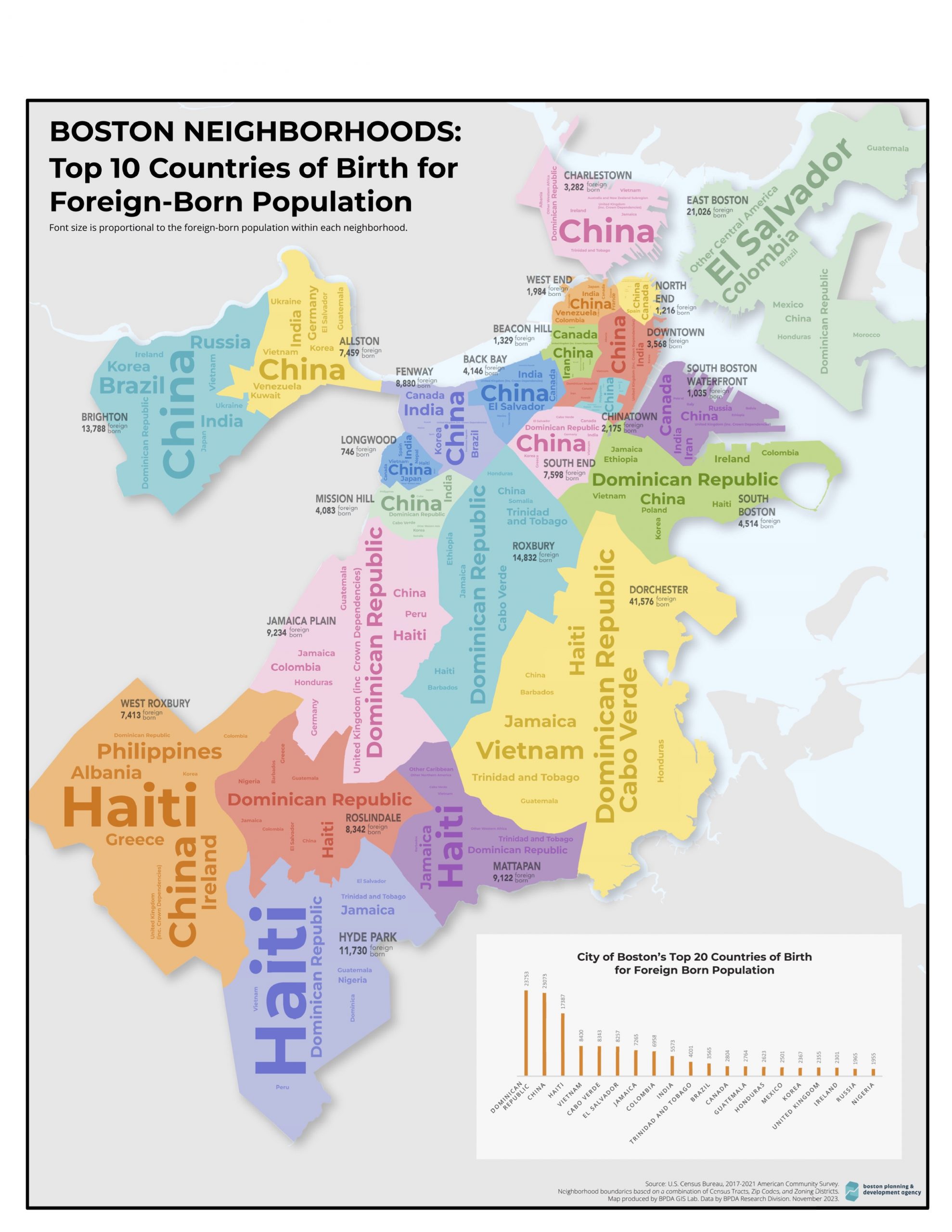
Map and data courtesy of the Boston Planning and Development Agency
Source: US Census, 2017-2021 American Community Survey. Neighborhood boundaries based on a combination of census tracts, zip codes, and zoning districts. Map produced by BPDA Office of Digital Cartography and GIS. Data by BPDA Research Division, November 2023.

